Problem Identification
If you've read our blogs, visited our office, or been to our workshops, chances are you'll see process maps at some point. My colleague Jess wrote a great blog post about it. Process mapping is a tool that has become an integral part of a larger body of work that encompasses about a quarter of most "innovation" projects handed to us -- the problem identification phase.
How We Right-Sized the API Team’s Project Load and Team Capacity
The role and mission of our team has been constantly evolving since our inception as a Bloomberg Philanthropies Innovation Team in 2015. As part of a cohort of I-Teams, our team members spent the majority of our efforts focused on solving one high-priority issue per year. Past priority areas have included: Water and Road Infrastructure, Economic Opportunity, Housing Stability, Permitting, and Quality of Life.
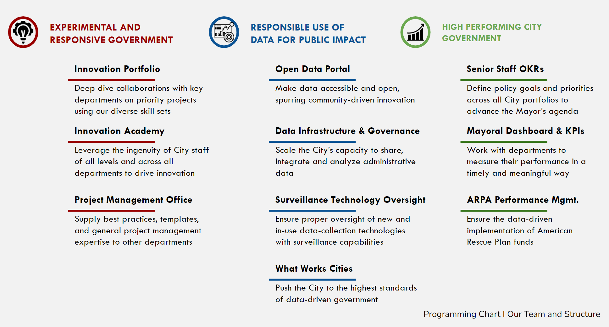
In our current iteration as the Office of Accountability, Performance, and Innovation, over time our mission has grown to take on a larger and more diverse set of challenges, including leading cross-department change management and data analysis projects, operating an open data portal, guiding the City’s data infrastructure and governance, and managing the City’s performance management strategy, among other supporting roles and responsibilities.
As this transition gradually occurred over time, we found ourselves spread too thin, with too many projects and not enough team members to adequately support our many initiatives. To help address this, we instituted three changes to how our team operates so that we can better serve our colleagues across City departments and deliver better services to our fellow City residents.
A Successful Deployment of the City of Syracuse's Snow Plow Map: What it Does, What We've Learned, and What We Plan to Do
Syracuse is no stranger to snow – historically we see an average of 124 inches a year and tend to be in the top 5 snowiest big cities in the country (from the Golden Snow Globe Competition). In an effort to share how we operate during a storm, we developed a snowplow map that shows when a street was last plowed.
Our Deputy Chief Innovation & Data Officer, Conor Muldoon, wrote a post outlining what led up to our current snowplow map and the potential impact of it right before we launched the tool in December here.
We have had several snow storms since the launch of the City’s Snow Plow map (ESRI’s Winter Weather Operations tool) the first week of December 2021. We successfully launched the tool to the public with the first large storm in January, tracking the plowed status of streets for three days, and saw around 12,000 hits over the course of the storm to the public viewer. We continue to maintain high engagement during the storms after, seeing consistent views of the tool throughout the storm’s length.
Syracuse Winter Weather Operations
In 2018, the Office of Accountability, Performance, and Innovation developed an in-house web application to track the City’s fleet of snow plow trucks and map street segments that had been plowed during winter storms in order to communicate to residents when their street had been plowed. The tool was exceptionally well-received and played an important role in the City’s communication strategy around an important public service delivery. However, last year the system experienced significant challenges with the underlying sensor technology and ran into limitations in the frequency of the network provider’s communications - resulting in performance issues that made the much-anticipated snow plow map no longer functional.
Despite extensive attempts to work around the inherent technical limitations, it became apparent that it was time to develop a more robust solution.
Performance Management at Syracuse: Why and How?
Meet our new Deputy Chief Innovation & Data Officer
Introducing Conor Muldoon who will help to lead the API team in data and innovation to find new and efficient ways to improve how the City of Syracuse delivers services. Conor will oversee the implementation of a city-wide performance strategy and the continuous expansion of the city’s data infrastructure. He will assist our Chief Innovation & Data Officer in championing the Mayor’s innovative and performance management vision for all city departments and constituents.


