There has been a lot written about smart cities. Professor Sam Musa defines a smart city as one that:
“engages its citizens and connects its infrastructure electronically. A smart city has the ability to integrate multiple technological solutions, in a secure fashion, to manage the city’s assets - the city’s assets include, but not limited to, local departments’ information systems, schools, libraries, transportation systems, hospitals, powerplants, law enforcement, and other community services. The goal of building a smart city is to improve the quality of life by using technology to improve the efficiency of services and meet residents’ needs.”
In this post, I’ll write about a few of the ways the City of Syracuse has tried using smart city technologies to further some different initiatives related to infrastructure. I’ll also write about some of the challenges and considerations we as a city will encounter going forward.
Leak detection sensors
Last year, Mayor Miner announced that the City would pilot a project to place sensors on water mains to help detect leaks in the system. If we could detect leaks, we would know where there was a threat for a break, and water crews could schedule a main repair during off hours and before it became an emergency. This would provide a heads up for both City crews and residents, and also reduce disruption on the street and in the neighborhood. Knowing where there are leaks could also signal that there might be additional issues with other underground infrastructure.
We continue to test sensors on the water mains, and remain optimistic about their potential.
Street Quality Identification Device
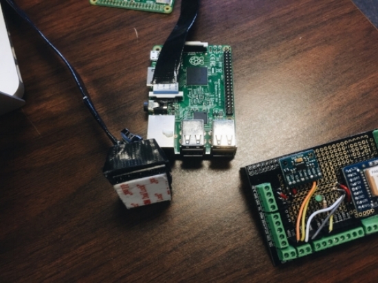
We worked with Argo Labs to pilot a low-cost device that is placed on a vehicle and takes pictures of the roads while also measuring their bumpiness. Our hope was that we could get a high-level understanding on where roads are the smoothest and the roughest, while also seeing what the road looks like where it has been reported as bumpy. The ultimate result would be to use this information as an input into how we make decisions about where to pave roads in the future. Additionally, since we have pictures, if someone calls to report a pothole, we could look at the images on that block and confirm the location of a pothole before sending a crew to fix it.
The first pilot went well, and while we are continuing to analyze the data, we think there is potential for more data collection of this kind in the future.
GPS
Each Department of Public Works vehicle has a GPS unit installed in it. While tracking vehicles can serve important purposes, we thought of using the GPS devices in another way. Historically, crews that filled potholes kept paper records of where they filled them. This made it difficult to accurately count and map where the potholes existed. Now, the durapatcher trucks that we use to fill potholes utilize these GPS units, and allow us to get automatic readings every time a pothole is filled. This system has eliminated the need for paper, and allows us to see where potholes have been filled.
In the future, we also hope to use this data to identify patterns and correlations between preventive road maintenance and where potholes form, which would allow us to more effectively deploy our city resources.
Data Smart
The initiatives listed above are a few of the ways the City has piloted smart city technologies in the past year. The City has also used data to predict risks, especially where water main breaks might occur. Though this does not make use of new technologies, it does analyze data in new ways. As we continue to use sensors and smart technologies we will expand the amount of data that we collect, which could lead to even more opportunities to predict infrastructure risk.
Challenges
While sensors and other new technologies offer exciting opportunities to the city, some challenges remain. For the City of Syracuse to become a smart city, we will need to do much more than simply buy new technology. We will also need to make some additional considerations:
Does the community understand what data is being collected and how it will be used? Do people support this data collection?
Does the data being collected help solve a problem we are currently facing?
Do our operating departments understand the outputs of the data, and are they able to easily make decisions based on the analysis of that data?
Are we making investments that are future-proof, or are we locking ourselves into technologies that will soon be outdated?
Are there private partners that could help with the collection of this data and benefit from it?
If private entities are installing sensors, do our regulations require that the public has access to some form of the data?
How is privacy being protected?
This is only the beginning of our conversations about these issues. The City of Boston recently put together a playbook considering many smart city topics. And in Chicago, they are piloting a smart city project called the Array of Things. Perhaps one day Syracuse will be doing something similar to these cities.
We’ll continue writing about our progress, but are interested in your thoughts, too. What new technologies do you want to see in Syracuse? What data do you want to see and how would it be used? Please post in the comments below!


